DroidEFB: EFB for Pilots (US)
- 4.0
- Rating
- 100.00K
- Installs
- Free
- Price

 Analysis by App-foxy
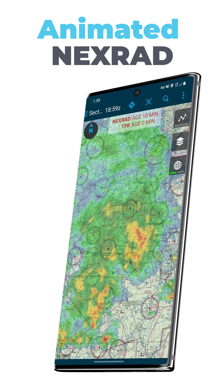
When I look at a flight-planning app, I do not judge it like a normal road-navigation tool. A pilot needs a clear chart workflow, dependable access to the right information, and enough control to avoid turning a busy cockpit task into a confusing phone exercise. DroidEFB: EFB for Pilots is aimed squarely at that job. It is a free aviation app from DroidEFB, LLC - Aviation GPS, designed for pilots in the United States who want VFR and IFR charts, geo-referenced approach plates, ADS-B support, and flight-plan filing in one place.
I found the appeal easy to understand: instead of moving between a general map app, a chart viewer, a flight-planning website, and separate tools for traffic information, this app tries to bring those aviation tasks together. That convenience matters before departure and during a quick cockpit check. At the same time, I would not treat it as an automatic replacement for a pilot’s normal preparation habits or approved onboard equipment. Its value depends heavily on how carefully I configure it, verify its information, and use it alongside sensible backups.
What DroidEFB does well for practical US flight preparation
The app belongs to the Maps & Navigation category, but its audience is much narrower than the category label suggests. This is not something I would install for driving directions or casual map browsing. Its purpose is electronic flight-bag work: looking at aviation charts, checking a route, viewing plates in a geographic context, and handling flight-plan tasks from a mobile device.
You May Also Like

 Blood Strike: 2.5 Anniversary
Blood Strike’s Loadouts Turn Every Drop Into a Tactical Gamble
A close look at Blood Strike’s custom loadouts: how fast access to signature weapons reshapes its battle royale rhythm, rewards preparation, and narrows the gap between fights.

 Pandora - Music & Podcasts
Pandora’s Music Is Easy to Start, but Harder to Recover
Pandora’s strength is its low-effort path from a seed to a station. Its weak spot is how much confidence it asks you to place in connection, setup, and quiet recovery.

 8 Ball Pool
 Is Built on Rivalries, Rematches, and Routine
A close look at the rivalries, rematches, shared routines, and unanswered safety questions that turn a quick pool match into a persistent mobile community.

 Samsung Music
’s Quiet Strength Is Playing What You Already Own
Its reach comes less from spectacle than from dependable access to a personal library. That simplicity is both the app’s strongest retention engine and its ceiling.

 AccuWeather: Weather Radar
AccuWeather Review: A Quick, Clear Forecast for Everyday Decisions
For everyday plans, the best forecast is the one you can understand quickly. AccuWeather makes rain timing, radar, and local conditions easy to act on, with a few trade-offs.

 Hill Climb Racing
Why Hill Climb Racing Still Turns Crashes Into One More Run
A tiny car, a bumpy hill and one more upgrade: Hill Climb Racing keeps resurfacing because its simple chaos makes every near-miss feel personal.
More From Our News Desk



That focus is its biggest strength. A general navigation app is built around roads, addresses, traffic, and turn-by-turn instructions. DroidEFB is built around the language and workflow of aviation. For a pilot who already thinks in terms of VFR charts, IFR procedures, airspace, and flight plans, that makes the interface conceptually more useful than a consumer map. I can approach a trip as a sequence of aviation decisions rather than trying to force it into a road-navigation layout.
The inclusion of both VFR and IFR chart support also gives the app broader usefulness than a tool limited to one type of flying. A VFR pilot may want a quick visual overview of airspace and landmarks, while an instrument pilot needs a more procedure-focused planning process. Those are different needs, and having both chart types available in one aviation-focused application reduces the need to switch tools during preparation.
Geo-referenced plates are another meaningful part of the experience. A static plate is useful for reading frequencies, altitudes, courses, and procedure notes, but placing that plate in relation to the aircraft’s position can make it easier to understand where the procedure fits geographically. I see this as especially helpful when mentally connecting a published approach with the surrounding airport environment. It does not remove the need to read the plate carefully, but it can make the relationship between the printed procedure and the moving flight picture easier to follow.
The ADS-B element adds a second layer to the app’s usefulness. It suggests a workflow in which compatible traffic and flight information can be brought into the same electronic flight-bag environment rather than viewed in isolation. I would still treat any traffic display as situational awareness rather than permission to relax visual scanning or normal radio procedures. The benefit is better context, not a replacement for pilot responsibility.
A workflow that makes sense before takeoff
For me, the most practical way to use this app would be before arriving at the aircraft. I would begin by reviewing the intended route on the appropriate chart, then open the relevant plates and check how the route relates to the departure, en-route, and arrival portions of the flight. After that, I would use the flight-plan filing tools if they fit the operation, and only then move to the aircraft for a final confirmation using the current information and the pilot’s normal checklist.
That order matters because it keeps the phone or tablet from becoming a last-second source of decisions. The app can help organize the planning process, but it should not encourage rushing through chart review simply because filing a plan is convenient. I prefer using it as a preparation workspace first and a cockpit reference second.
A realistic example would be a weekend cross-country flight where I need to compare a VFR route with nearby controlled airspace, identify the destination procedure information, and prepare the flight-plan details before leaving home. In that situation, having charts, geo plates, and filing tools in one aviation-specific app could save time and reduce the number of separate services I need to open. Once at the aircraft, I would verify that the device has the needed material available and that my backup plan is ready before relying on it.
One less obvious advantage is the reduction of context switching. Every time I move from a chart source to a filing page and then to a separate traffic display, I create another opportunity to lose the thread of the planning task. A unified workflow can help me notice inconsistencies earlier, such as a route that looks reasonable on one screen but does not fit the procedure I intend to use. That is not a guarantee of correctness, but it is a useful planning habit.
What the version and platform requirements mean in practice
The current version is 2.9.8, and the app requires Android 8.0 or later. That requirement is modest enough for many still-serviceable Android devices, but I would check the operating system before choosing an older tablet as a dedicated cockpit device. Aviation apps are often used on hardware that stays mounted or stored for a long time, so compatibility should be checked before investing effort in setting up a particular device.
The app is free to install, with in-app purchases ranging from one dollar to one hundred forty-nine dollars and ninety-nine cents per item. That is important because “free” does not necessarily mean that every aviation resource or advanced workflow is included without additional cost. Before building a complete planning routine around it, I would inspect the purchase choices inside the app and decide which parts are genuinely needed for my type of flying.
I also like to separate the installation decision from the operational decision. Installing a free app for evaluation is low commitment. Depending on it for a flight is a much higher commitment. I would first test chart handling, route entry, plate viewing, filing steps, and any connection with my equipment while on the ground. Only after that would I decide whether it deserves a regular place in my electronic flight bag.
Trust, controls, and the moments that deserve caution
The developer is listed as DroidEFB, LLC - Aviation GPS, and the app has an average rating of 4.0 from around seven hundred forty-five ratings, with more than three hundred reviews. It has reached over one hundred thousand installs and carries an Everyone content rating. Those details show that it has a real user base and a clear aviation purpose, but they do not by themselves prove that it is suitable for every pilot or every flight. I read the rating as a reason to investigate the workflow, not as a substitute for testing it myself.
When I evaluate trust in an app like this, I focus on visible choices rather than assumptions. I want to know what I am being asked to enable, what information I am entering, which functions require an account or connection, and whether I can review a filing or route before submitting it. In aviation, a small confirmation step is valuable because it gives me a chance to catch an incorrect identifier, altitude, date, or routing detail before it becomes an operational problem.
Flight-plan filing is the clearest data-sensitive moment. It involves information that should be entered deliberately, not casually, and I would avoid treating the filing screen as a place to experiment while distracted. My preferred habit is to prepare the route separately, compare the entries against my planning notes, and review the final summary before sending anything. If the app presents account controls or saved details, I would also check those periodically so old information does not silently carry into a new flight.
ADS-B creates another moment where user judgment matters. Traffic and aircraft-related information can be operationally useful, but the quality of the overall picture depends on the connected equipment, reception, configuration, and the limits of the service. I would keep the display useful but secondary: it can help me build awareness, yet it should not replace lookout, communication, or the procedures appropriate to the aircraft and airspace.
Chart and plate use deserves the same discipline. A geo-referenced display can make position awareness more intuitive, but I would not let the moving map become a shortcut around reading the published procedure. I would review the complete plate, including notes and restrictions, and use the geographic overlay as an aid to understanding rather than as the only source of interpretation.
Where the app may frustrate experienced users
The all-in-one idea also creates a trade-off. A broad aviation tool can be more convenient, but it may not feel as deep or specialized as a dedicated chart service, a dedicated flight-planning platform, or equipment-specific ADS-B software. Pilots who already have a carefully tuned ecosystem may find that adding another app creates duplication instead of simplification.
There is also a learning curve. A road map app can be opened and understood quickly; an electronic flight bag requires more deliberate setup. I would expect to spend time learning how the charts are organized, how geo plates behave, how routes are entered, and how filing is confirmed. That effort is worthwhile only if the resulting workflow is faster and clearer than the alternatives I already trust.
The purchase structure may be another source of friction. Since individual in-app items can reach a substantial amount, I would not assume that the initial free download tells the whole cost story. A pilot on a limited budget should identify the specific chart, filing, or equipment-related functions needed before paying for anything. A pilot who wants a single predictable subscription or an established professional chart ecosystem may prefer a different option.
Device ergonomics matter too. A phone can be convenient for planning at home, but a small screen may be less comfortable for detailed chart review, especially when I need to compare several pieces of information. A larger Android tablet may be more practical, provided it meets the operating-system requirement and is mounted or positioned safely. I would never allow the app’s convenience to create a distraction during a critical phase of flight.
Who should use it, and who should choose another tool
I think DroidEFB is best suited to US pilots who want an Android-centered aviation planning tool and are willing to verify its workflow on the ground. It is particularly attractive to someone who values having VFR and IFR chart work, geo-referenced plates, ADS-B-related awareness, and flight-plan filing available within one aviation application. It can also be a useful secondary tool for a pilot who wants a separate planning environment rather than putting every task into one established platform.
I would be more cautious about recommending it as the only electronic reference for a pilot who has not yet developed a backup routine. New pilots may appreciate the concentration of features, but they also need to understand what the app is showing and what still requires independent verification. The app can support good habits; it cannot create them automatically.
It may not be the right choice for someone who primarily flies outside the United States, since its stated focus is US electronic flight-bag use. It is also less compelling for a pilot who already receives charting, traffic, and filing through aircraft equipment or another service that is deeply integrated into the cockpit. In that case, the extra app may add another login, another update process, and another screen without solving a real problem.
For occasional recreational flying, the free entry point makes evaluation easier, but I would still examine the purchase requirements before deciding whether it is economical over time. For regular instrument operations, I would compare the app’s actual chart workflow and update process with the dedicated alternatives I already use. The better choice is the one that makes verification simpler, not merely the one that contains the most functions.
My cautious verdict after looking at the whole workflow
The strongest reason to try DroidEFB is the way it brings several US aviation tasks into one focused workspace. VFR and IFR charts, geo-referenced plates, ADS-B support, and flight-plan filing address real planning needs, and the app’s free installation makes it reasonable to test without an immediate commitment. Its Android 8.0 requirement also leaves it accessible to a range of devices that are not brand new.
My recommendation comes with clear boundaries. I would test every important workflow before flight, review the purchase choices carefully, and treat filing and traffic displays as tasks requiring active confirmation. I would also keep a backup method for charts and planning rather than assuming that one mobile app can cover every failure or connectivity situation.
The app’s 4.0 average from its existing ratings suggests a generally useful product with room for individual differences in experience. That feels consistent with what I would expect here: pilots who fit its workflow may find it practical, while pilots seeking a highly specialized or fully integrated professional ecosystem may prefer another solution. For me, it earns a cautious recommendation as a planning and reference companion, especially for Android users who want aviation-specific tools in one place. I would adopt it gradually, verify its behavior on the ground, and let its real-world clarity—not the feature count alone—decide whether it becomes part of my regular flight routine.
FAQs for DroidEFB: EFB for Pilots (US)
01What is DroidEFB: EFB for Pilots, and who is it designed for?
DroidEFB: EFB for Pilots is an electronic flight bag application intended to help pilots organize and access important flight information from a mobile device. It may be useful for student pilots, private pilots, and aviation professionals who want digital tools for planning, reference, and in-flight organization. Before relying on it operationally, users should confirm that its available features, charts, and data meet their aircraft, region, and regulatory requirements.
02Does DroidEFB: EFB for Pilots include official aviation charts, navigation data, or weather information?
The availability of charts, airport information, navigation data, weather details, and other aviation resources can depend on the app version, subscription model, location, and installed data packages. Users should carefully review the current feature list and update information before downloading. An electronic flight bag should not automatically be treated as a replacement for approved navigation sources, current official publications, or required paper backups.
03Can DroidEFB: EFB for Pilots be used during an actual flight?
The app may be useful in the cockpit for reference and flight organization, but whether it can be used as an approved operational tool depends on the pilot, aircraft, operator, and applicable aviation authority. Pilots should verify device compatibility, battery endurance, mounting requirements, offline access, and the currency of all data. Always follow the aircraft flight manual, company procedures, and local regulations rather than relying exclusively on a mobile application.
04Does DroidEFB: EFB for Pilots work without an internet connection?
Offline functionality is especially important for pilots because mobile coverage may be unavailable during flight. Users should check which maps, documents, airport information, and other resources can be downloaded for offline use and whether they require periodic online updates. Before departure, it is sensible to open the required materials in airplane mode and confirm that they remain accessible, while also carrying any backup information required for safe and compliant operations.
05Is DroidEFB: EFB for Pilots free to download, and are there in-app purchases?
The download price and any additional costs may vary between Android and iOS, as well as by country and app version. Some aviation applications provide basic tools at no cost while charging for premium features, updated databases, charts, storage, or subscriptions. Before installing, review the store listing for current pricing, renewal terms, supported devices, and cancellation conditions so you understand the total cost of using the app.
Pros
- Provides quick access to essential aviation reference material.
- Designed around cockpit use with a practical
- pilot-focused interface.
- Useful for organizing flight documents and operational information.
- Can reduce reliance on bulky printed charts and manuals.
- Helpful companion for pilots who prefer a dedicated EFB workflow.
Cons
- Coverage and features may vary depending on region and subscription plan.
- Requires current data to ensure charts and documents remain reliable.
- Some advanced aviation tools may be missing compared with larger EFB suites.
- A larger screen is preferable for comfortable chart and document viewing.
- Pilots should verify all information against official
- up-to-date sources.

DroidEFB: EFB for Pilots (US)
Gallery